Back to Weather

5-day forecast / Denison, TX

ThursdaySlight Chance Showers And Thunderstorms84° / 53° 58%
FridayMostly Sunny62° / 46° 14%
SaturdaySunny63° / 43°
SundaySunny68° / 48°
MondaySunny74° / 53°

Wind Advisory in Effect for Denison; Humid Start to the Day - Oct 15, 2 PM

Denison weather, updated every four hours — local forecasts you can trust.

A Wind Advisory is active for Denison as high humidity lingers. Showers and thunderstorms are likely today, followed by a significant cooldown and gusty winds tomorrow.

Briar Iverson

October 15, 20262 min read

National Weather Service radar for North Texas (KFWS)

*As of Oct 15, 2 PM local time.*

Active Alerts and Current Conditions

A Wind Advisory with moderate severity and expected urgency is currently in effect for Denison. This alert remains active until 7:00 PM CDT on October 16. The advisory was issued by the National Weather Service in Fort Worth, indicating conditions that warrant caution regarding wind impacts.

Right now, the air feels heavy and muggy. The current temperature is 79F, but it feels like 82F due to the moisture in the air. Relative humidity sits at 79%, with a dew point of 72F, creating a notably humid environment. Winds are currently light at 5 mph with gusts reaching 8 mph, and the sky is overcast.

Today's Forecast: Rain and Rising Winds

Today brings a mix of rain and wind. There is a slight chance for showers and thunderstorms before 4pm, followed by a likely period of showers and thunderstorms later in the day. The high will reach near 84F, though temperatures may drop to around 82F in the afternoon as clouds build.

Precipitation chances are high at 60% today. Residents can expect new rainfall amounts between a tenth and a quarter of an inch. Winds will shift to the west at 5 to 10 mph.

As evening approaches, conditions will remain unsettled with showers and thunderstorms likely before 4am. The low will settle near 53F. Overnight winds will increase significantly from the north northwest, blowing at 10 to 20 mph with gusts as high as 30 mph.

Rainfall totals for tonight could range between a half and three quarters of an inch.
Tomorrow: Cooler and Breezy

Tomorrow brings a sharp change in weather patterns. The sky will be mostly sunny, offering a break from the rain, but temperatures will drop considerably. The high will only reach near 62F, a significant cooldown from today's peak.

Winds will continue to pick up from the north, averaging around 20 mph with gusts as high as 35 mph. While precipitation chances drop to just 14%, trace amounts of rain less than a tenth of an inch are still possible.

As tomorrow night arrives, skies will turn partly cloudy with a low around 46F. North winds will persist at 10 to 20 mph, with gusts up to 30 mph. With the wind advisory in place and temperatures falling, it is wise to secure loose outdoor items and dress in layers to stay comfortable in the brisk conditions.

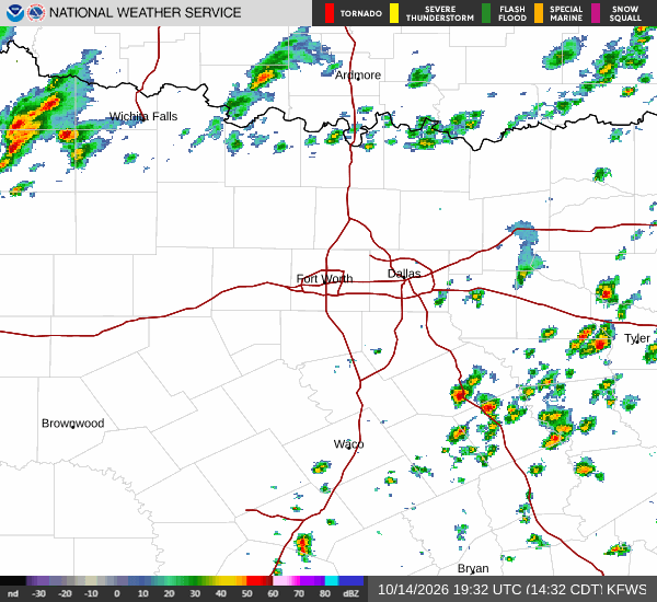
National Weather Service radar for North Texas (KFWS)

Sources

National Weather Service radar

National Weather Service forecast data

Open-Meteo weather data

Share

Briar Iverson

Briar Iverson covers weather, storms, and seasonal life around Denison.

Related Stories

More in Sport

Sport

Parker’s Booth Move Comes With a Familiar Adviser

Mike Pettine knows Christian Parker from Green Bay. Their reunion gives Dallas experience around its defensive coordinator as Parker prepares to call games from upstairs.

Reese StroudOctober 14, 20263 min read