Back to Weather

5-day forecast / Denison, TX

WednesdayScattered Showers And Thunderstorms93° / 72° 36%
ThursdayShowers And Thunderstorms78° / 69° 87%
FridayScattered Showers And Thunderstorms80° / 66° 52%
SaturdayScattered Rain Showers77° / 65° 47%
SundayChance Rain Showers81° / 63° 29%

Denison Heat Advisory: Highs Near 103F, Humidity Low - Aug 16, 11 AM

Denison weather, updated every four hours — local forecasts you can trust.

A Heat Advisory is active for Denison. Current temperatures are 90F with a heat index of 91F. Today's high will reach 103F with sunny skies and minimal rain chances.

Briar Iverson

August 16, 20262 min read

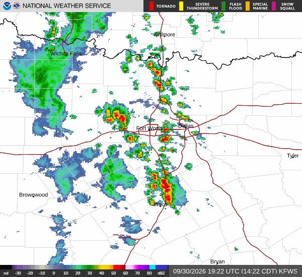
National Weather Service radar for North Texas (KFWS)

*As of Aug 16, 11 AM local time.*

Current Conditions and Alert Status

A Heat Advisory is currently in effect for the Denison area, issued by the National Weather Service in Fort Worth. This moderate-severity alert remains active until 8:00 PM CDT. Residents should be aware that conditions are already intense, with the air temperature sitting at 90F and the feels-like temperature at 91F.

The relative humidity is 43%, and the dew point is 64F. Winds are blowing from the southwest at 12 mph, with gusts reaching 15 mph. The sky is currently clear, providing direct solar radiation that contributes to the rising heat index.

Today's Forecast

Today will be sunny with a high near 103F. The heat index values are expected to reach as high as 107F, making the air feel significantly hotter than the actual temperature. The chance of precipitation is only 1%, meaning dry conditions will persist throughout the day.

Southwest winds will shift to a lighter 5 to 10 mph as the day progresses. The low temperature tonight will be near 80F, though temperatures may rise to around 82F overnight. The sky will remain mostly clear, and the heat index will stay elevated at 107F.

South southwest winds will be around 5 mph.
Tomorrow's Outlook

Tomorrow will continue the hot trend with sunny skies and a high near 105F. The heat index is projected to peak at 108F. The chance of rain remains negligible at 2%.

West southwest winds will be around 5 mph. Tonight, the sky will be clear with a low around 80F, potentially rising to 82F. The heat index will remain high at 107F, with south southeast winds around 5 mph.
Given the sustained high temperatures and heat index values, it is crucial to stay hydrated and limit outdoor exertion during the hottest parts of the day. Check on neighbors who may be vulnerable to the heat, and ensure that anyone spending time outside has access to water and shade.

These conditions are expected to persist, so planning for heat safety is essential for both today and tomorrow.

National Weather Service radar for North Texas (KFWS)

Sources

National Weather Service radar

National Weather Service forecast data

Open-Meteo weather data

Share

Briar Iverson

Briar Iverson covers weather, storms, and seasonal life around Denison.

Related Stories

More in Sport

Sport

Dallas Stars’ Traverse City Choice Faces Its First Real Test

Tuesday’s final practice gave Dallas structure during an unusual preseason gap. Friday against St. Louis and Saturday at Nashville will show whether two sessions preserved enough rhythm for the opening back-to-back.

Reese StroudSeptember 30, 20264 min read